Many minerals display spectral features in the thermal infrared spectral range. Remote hyperspectral imaging allows the mapping of large areas. Here, a geological survey was carried out in an asbestos open-pit mine. We were able to detect the spectral signature of serpentine from a faraway distance.
Need some answers? Ask our experts!
Contact us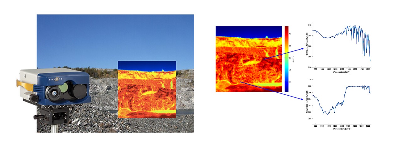
The full power of the Telops’ Hyper-Cam can be brought in flight using the Hyper-Cam Airborne Mini. High spatial and spectral resolution hypermaps can be readily be obtained for geological surveys, pollution monitoring, and surveillance applications. Data is easily geo-referenced with Google Earth.
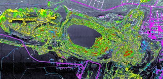
Image below: A hyperspectral map of the same open-pit mine was generated with Telops’ Hyper-Cam Airborne Platform (a former product from Telops which has since been replaced with the Hyper-Cam Airborne Mini).
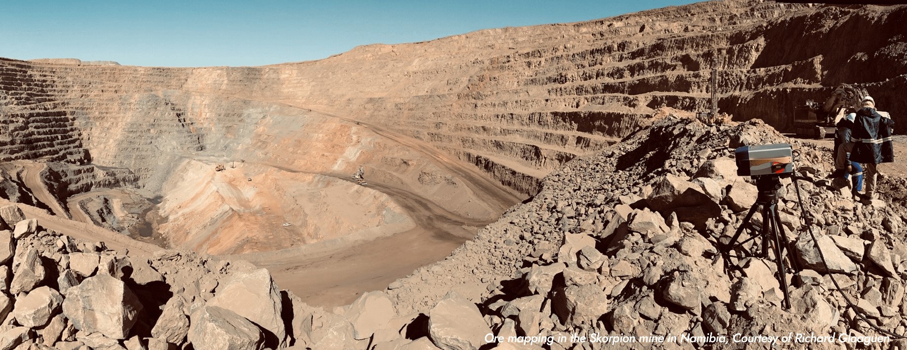
In this image: The Helmholtz Institute Freiberg for resource technology is developing innovative tools for the raw materials sector. A key component is provided by Telops with remarkable LWIR sensors. Here the Telops Hyper-Cam is used for ore mapping in the skorpion mine in Namibia. Imaging spectroscopy allows for a rapid and safe assessment of the mine face prior and after blasting.
